All the Essex Cities, Towns, and Villages Which Could Be Underwater by 2050
Climate change poses a significant threat to communities worldwide, and Essex is no exception. Recent studies have highlighted the potential for devastating floods that could submerge several parts of the region by 2050, just a short 25 years from now.
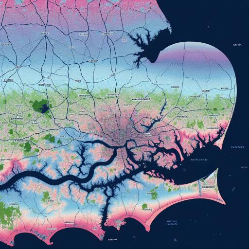
An innovative coastal risk screening tool developed by climate experts has mapped out areas across Essex that are most vulnerable to rising sea levels. This tool, grounded in advanced climate science, provides a visual representation of what might lie in store for Essex if current trends continue.
From 2030 onwards, predictions indicate some parts of Essex could start experiencing annual flood levels, culminating in significant inundations come 2050. These projections offer a critical warning and emphasize the urgency of addressing climate change to protect these at-risk areas.
The map created by climate scientists uses peer-reviewed research published in leading academic journals to chart areas under threat. These maps are designed as preliminary screening tools, pinpointing regions that warrant further, more detailed risk analysis. Understanding these maps can help local authorities, policymakers, and communities prepare and adopt suitable mitigation strategies.
The visualization of Essex’s potentially vulnerable regions shows vast tracts of land depicted in red, indicating locations that might be submerged based on future projections. While these maps serve as early warnings, they also prompt immediate action to mitigate the impacts of impending climate risks.
The repercussions of ignoring these signs are stark. Homes, infrastructure, and livelihoods could face obliteration. Furthermore, the ecological balance in these areas might be disturbed, causing lasting environmental impacts. While some strategies can be implemented to protect these areas from rising waters, much of the solution lies in reducing the overall anthropogenic factors contributing to climate change.
As Essex reflects on these dire predictions, it prompts a broader dialogue on sustainable practices, accountability in carbon emissions, and a unified commitment to global climate agreements. Preparing for and addressing such environmental threats will ensure that Essex, along with other regions susceptible to climate change, can safeguard its communities and ecological systems.
The screening tool’s visualization is an invaluable resource, urging all stakeholders to engage in proactive planning while simultaneously promoting adaptation strategies to cope with future flooding scenarios. As Essex confronts these predictions, community resilience and innovative engineering will play crucial roles in shaping a more sustainable and secure future.


Leave a Reply